
Sebastian Inlet Conditions
Everything a boater or angler checks before pushing off: live NOAA tides for the inlet, the webcam, every public ramp nearby, and the exact route from our dock to the sandbar. Kept current by hosts who run it most mornings.
Read the water first
Sebastian Inlet is one of the strongest running inlets on Florida's east coast. The current at the mouth builds through the ebb, and a boat that handles the lagoon comfortably can find the inlet a very different place two hours later. Three things decide the day: the stage of the tide, the wind against that current, and how much traffic is stacked at the jetty.
The tide panel here comes straight from NOAA station 8722004 at the inlet. For the wind and the lineup, the six live camera views tell you more in ten seconds than any forecast.
Sebastian Inlet tides
NOAA stationLoading tide predictions…
Predictions for NOAA station 8722004 (Sebastian Inlet bridge), MLLW datum, local time. Outgoing tide against an east swell makes the inlet mouth roughest — the calmest run out is near slack water at the tide change.
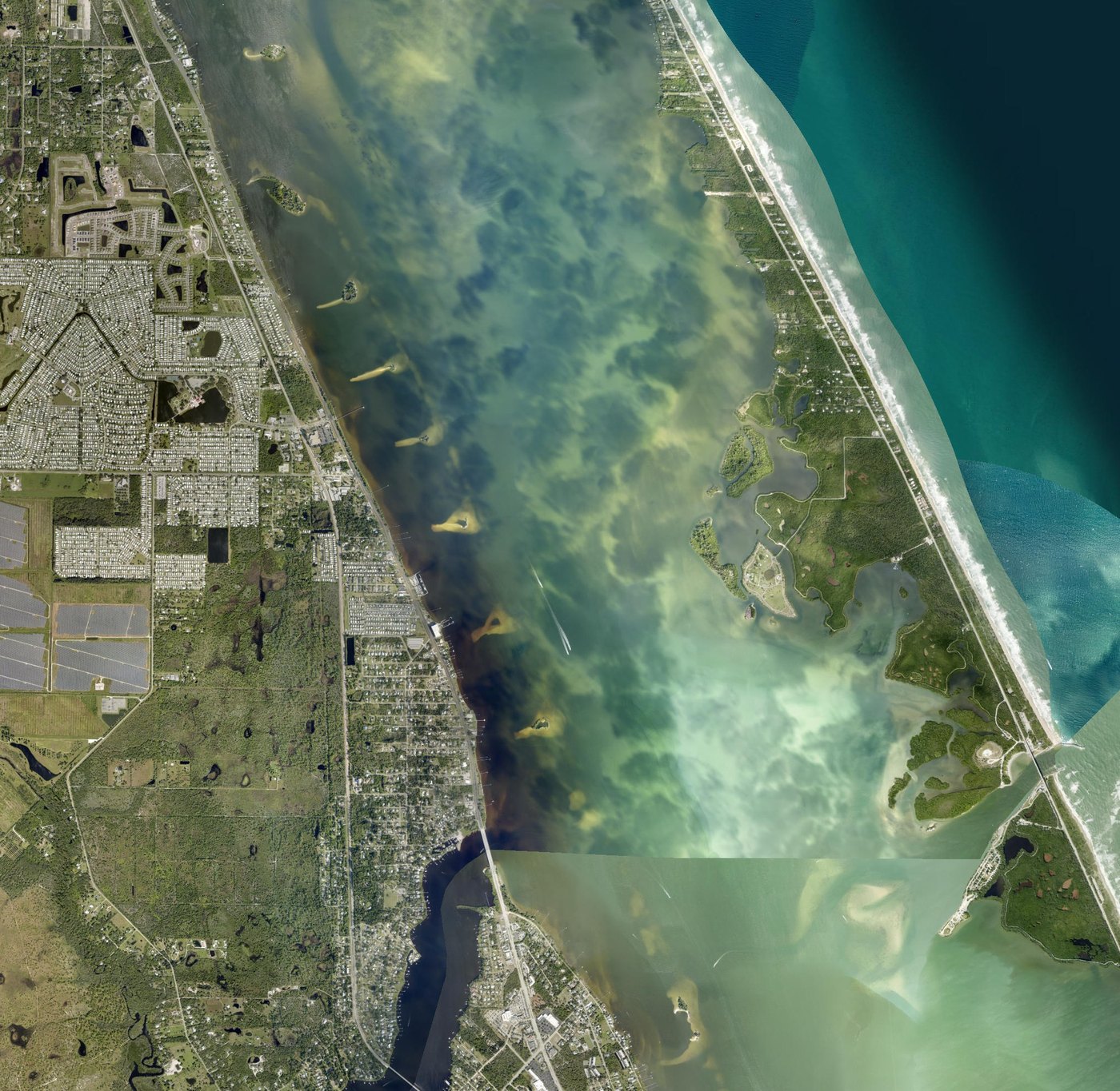
Grant-Valkaria to the Sebastian Inlet sandbar
Traced waypoint by waypoint over satellite imagery, with mile marks along the way: out of the cove into the Indian River, south down the Intracoastal past the Long Point Park islands, then east toward Coconut Point and the sandbar. Measured length: 5.36 statute miles.
Public ramps within 25 minutes
| Ramp | From the house | Lanes & fee | Best for |
|---|---|---|---|
| Grant Boat Ramp | 1.2 mi · 3 min | 1 lane · free | Fastest lagoon launch, no bridges |
| Micco / Barefoot Bay | 2.0 mi · 6 min | 2 lanes · free | Big rigs and busy weekends |
| Sebastian Yacht Club | 8 mi · 15 min | 2 lanes · free | Sandbar and spoil islands |
| Sebastian Inlet State Park | 12 mi · 20 min | 2 lanes · park fee | Ocean access in five minutes |
| Goode Park (Turkey Creek) | 10 mi · 18 min | 1 lane · free | Kayaks and manatees |
| Long Point Park | 13 mi · 22 min | 1 lane · county fee | North side of the inlet |
Lanes, trailer parking, cleaning tables and local launch notes for each one: the full ramp guide.
Distances and dock specs
- Private dock → Sebastian Inlet sandbar
- 5.36 statute miles (4.66 nautical)
- Sandbar → inlet mouth at the A1A bridge
- 1.06 additional miles
- Dock frontage on the Indian River Lagoon
- approx. 50 feet
- Largest boat kept at the dock year-round
- 26 feet
- Closest public ramp (Grant)
- 1.2 miles by road
- NOAA tide station used on this page
- 8722004 — Sebastian Inlet, FL
Anyone is welcome to use or cite this page. If you run a tackle shop, a charter, a paddling outfit or a local guide and want something verified from the water — a depth at a given tide, what the basin looks like on an outgoing — just ask us.
Sebastian Inlet, tides and ramps
What is the tide doing at Sebastian Inlet right now?
The tide panel on this page pulls live predictions from NOAA station 8722004 at Sebastian Inlet, so it shows the next high and low water without leaving the page. The inlet runs hard on an outgoing tide; most local boaters time the run out for the last of the flood or slack water.
How far is the Sebastian Inlet sandbar by boat from Grant-Valkaria?
About 5.36 statute miles (4.66 nautical) from our private dock at 6910 US-1, staying inside the Indian River Lagoon and the Intracoastal Waterway the whole way, then turning east toward Coconut Point. The inlet mouth at the A1A bridge is roughly one mile beyond the sandbar.
Is there a live webcam at Sebastian Inlet?
Yes. Six views cover the north jetty, the surf, the wide inlet mouth and the west shot back into the lagoon. We embed all six on our live cam page so you can read the wind, the current and the boat traffic before you launch.
Which boat ramp is closest to Sebastian Inlet?
The ramp inside Sebastian Inlet State Park puts you in the inlet in under five minutes. From the Grant-Valkaria side, the Grant Boat Ramp is the closest launch to the lagoon route and is free.
Can I keep my own boat at the house instead of trailering every day?
Yes. The dock has roughly 50 feet of frontage on the lagoon and handles a 30-foot boat year-round, and larger boats are often fine if you check with us first, and there is driveway space for a truck and trailer. Most boating guests launch once and keep the boat in the water for the whole stay.
Staying on this stretch of the lagoon
Sunrise on the River is a 3-bedroom waterfront home at 6910 US-1, Grant-Valkaria, with roughly 50 feet of private dock, kayaks and paddleboards, and driveway space for a truck and trailer.